Trail Running Autrans-Méaudre en Vercors - UTV 2018 - Photo
© OpenStreetMap contributors
Length
Length
85 km
Max alt
Max alt
2094 m
Uphill gradient
Uphill gradient
4845 m
Km-Effort
Km-Effort  
150 km
Min alt
Min alt
856 m
Downhill gradient
Downhill gradient
4845 m
Boucle
Boucle
Yes
Creation date :
2019-01-15 13:42:49.377
Updated on :
2019-01-15 13:42:49.377

(0 Reviews)

Running
Running
10h00
Difficulty : Difficult

Scan this QR Code to open this trail in the SityTrail application

FREE GPS app for hiking

Logo SityTrail SityTrail

IGN / Geographical institutes

Download SityTrail from the App Store Download SityTrail from Google Play

Logo SityTrail SityTrail World

The world is yours!

Download SityTrail from the App Store Download SityTrail from Google Play Download SityTrail on Huawei AppGallery

About

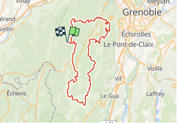
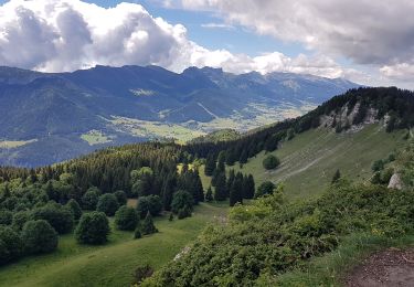
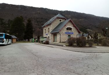
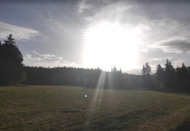
Trail Running of 85 km to be discovered at Auvergne-Rhône-Alpes, Isère, Autrans-Méaudre en Vercors. This trail is proposed by foxtrot51.

Elevation profile

Positioning

Country:
France
Region :
Auvergne-Rhône-Alpes
Department/Province :
Isère
Municipality :
Autrans-Méaudre en Vercors
Location:
Unknown
Start:(Dec)
Start:(UTM)
698768 ; 5000141 (31T) N.

Trails nearby

Trail Snowshoes Autrans-Méaudre en Vercors - Le Gros Martel - Méaudre - Photo
Snowshoes
tracegps

Snowshoes

Medium
(4)
Autrans-Méaudre en Vercors, Auvergne-Rhône-Alpes, Isère, France
4.9 km | 8.4 km-effort
2h 10min
Yes
Trail On foot Rencurel - La Balme Noire par la vire de Haute Valette - Photo
On foot
cmarit

On foot

Difficult
(1)
Rencurel, Auvergne-Rhône-Alpes, Isère, France
10.5 km | 21 km-effort
Unknown
Yes
Trail Bicycle tourism Villard-de-Lans - col d'Herbouilly/route des Goulets/Pont en Royans/gorges de la Bourne - Photo
Bicycle tourism
cmarit

Bicycle tourism

Difficult
Villard-de-Lans, Auvergne-Rhône-Alpes, Isère, France
60 km | 86 km-effort
6h 21min
No
Trail Walking Rencurel - Pas de la Chêvre pas des rages vire de la Ferrière - Photo
Walking
randochu

Walking

Very difficult
Rencurel, Auvergne-Rhône-Alpes, Isère, France
21 km | 37 km-effort
8h 23min
Yes
Trail sport Autrans-Méaudre en Vercors - 2022-12-26_12h42m52_suuntoapp-Walking-2022-12-26T08-59-38Z-route - Photo
sport
jeanfcd

sport

Very easy
(1)
Autrans-Méaudre en Vercors, Auvergne-Rhône-Alpes, Isère, France
8.8 km | 13.1 km-effort
Unknown
Yes
Trail Walking Autrans-Méaudre en Vercors - Le Gros Martel par le trou de L'enfer - Photo
Walking
crocau

Walking

Very easy
Autrans-Méaudre en Vercors, Auvergne-Rhône-Alpes, Isère, France
6.6 km | 10.1 km-effort
2h 36min
Yes
Trail Mountain bike Lans-en-Vercors - Lans - Charande - La Molière par les crêtes  - Photo
Mountain bike
patjobou

Mountain bike

Medium
Lans-en-Vercors, Auvergne-Rhône-Alpes, Isère, France
23 km | 35 km-effort
3h 31min
Yes
Trail Walking Lans-en-Vercors - La ronde de Lans - Photo
Walking
crocau

Walking

Very easy
(1)
Lans-en-Vercors, Auvergne-Rhône-Alpes, Isère, France
5.5 km | 7.4 km-effort
1h 27min
Yes
Trail Walking Lans-en-Vercors - Autrans-Méaudre en Vercors Marche à pied - Photo
Walking
Krystoff Radisson

Walking

Medium
Lans-en-Vercors, Auvergne-Rhône-Alpes, Isère, France
6.1 km | 9.7 km-effort
2h 0min
Yes


Close
My subscriptions